 Photo:
Visiting Haveli
What the place is like
Haveli sits at roughly 1,000 metres in the Pir Panjal foothills, in the south-east of Azad Kashmir. The town spreads along a ridge above the Betaar Nala, a stream that drains the surrounding slopes. Houses are mostly concrete and brick, with older timber-and-stone buildings in the villages. The bazaar is busy in the morning and quiet by late afternoon.
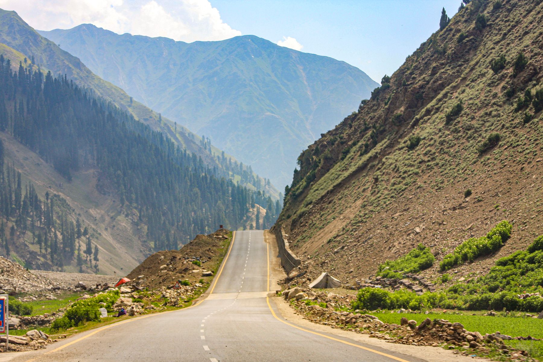
The landscape is softer than the high mountains further north. Terraced fields step down the slopes, maize is grown in summer and wheat in winter, and pine forest covers the upper ridges. In spring the hillsides carry blossom and new grass. In summer the town is warm by day and cool at night. Winter brings rain and occasional snow on the higher ground.
Weather through the year
April to June is mild and green. July and August bring the monsoon, with heavy rain and cloud on the ridges. September and October are clear and dry, with good views. December to February is cold, with rain in the valley and snow on the higher slopes, and some roads can be affected.
What to see
The main draw is the countryside rather than individual monuments. Walks from the town follow the stream and the terraced fields, and forest tracks climb to villages on the ridges above. The viewpoint at Khai Gala, on the Rawalakot road, gives a wide view over the basin.
Forward Kahuta, east of Haveli, is a small town with a bazaar and a spread of hamlets around it. The road there passes through pine and terraced farmland. Further afield, the valleys around Rawalakot and the Neelum Valley are separate trips, each needing its own day or more.
Walking from town
Paths leave Haveli in several directions, following the stream or climbing to the pine ridges. Local routes connect villages and are used by residents, so ask in the bazaar about the condition of any path before setting out. Walking is the best way to see the terraces and forest at close range.
A day or two there
One day covers the bazaar, a walk along the Betaar Nala and the short climb to the pine ridges above town. Add the Khai Gala viewpoint on the way in or out for a wider view of the basin.
With two days, take the road east to Forward Kahuta and walk in the surrounding hamlets, or spend a second day on the forest tracks. Mornings are clearer, so plan viewpoints and walks early. Evenings are for the bazaar and a simple meal.
Getting there and around
Haveli is reached by road from Rawalakot, roughly two hours by car on a hill road that passes Khai Gala. Rawalakot is the main gateway for the district, with road links onward to Muzaffarabad and to Islamabad via the hills. Shared transport and taxis run on the main routes; services are more frequent in the morning.
Within the town, most places are within walking distance. For villages and viewpoints, a local taxi or a hired car is the practical option. Roads are narrow and winding, and travel times are longer than the map suggests.
Permits and advice
Parts of Azad Kashmir near the Line of Control, and some border districts, can require a No Objection Certificate (NOC) or fall under travel advisories. Rules change, so check current official advice before travelling and carry identification. Some roads close in winter.
Practical notes
Accommodation in Haveli is limited to simple local places. Rawalakot has a wider choice and works as a base for the district. Eating is basic: bazaar shops serve everyday food, and larger meals are easier to find in Rawalakot.
Mobile coverage is patchy in the valleys and on the ridges. Bring cash, since card payment is rare outside the main towns, and carry rain gear from July to August. A fee may be charged at some viewpoints or private tracks.
Health and safety
Medical facilities are basic, so carry any medicines you need and treat Rawalakot or Islamabad as the nearest place for serious care. Tell someone your route before walking in the forest, and avoid unfamiliar paths after dark.
Frequently asked questions
Where is Haveli in Azad Kashmir?
Haveli is a small district town in the Pir Panjal foothills of Azad Kashmir, south-east of Rawalakot. It sits at roughly 1,000 metres above sea level and is reached by a hill road from Rawalakot that takes about two hours.
When is the best time to visit Haveli?
April to June and September to October are the most comfortable months, with mild weather and clearer views. July and August bring monsoon rain, and December to February is cold, with snow on the higher ridges and possible road disruption.
Do you need a permit to visit Haveli?
Haveli itself is usually reached without a special permit, but parts of Azad Kashmir near the Line of Control and some border districts can require a No Objection Certificate. Rules change, so check current official advice before travelling and carry identification.
What is there to see around Haveli?
The main sights are the bazaar, the Betaar Nala stream and the terraced fields, the pine ridges above town and the Khai Gala viewpoint on the Rawalakot road. Forward Kahuta, a small town to the east, makes a half-day trip.