 Photo:
Visiting Gorakh Hill
What it is like
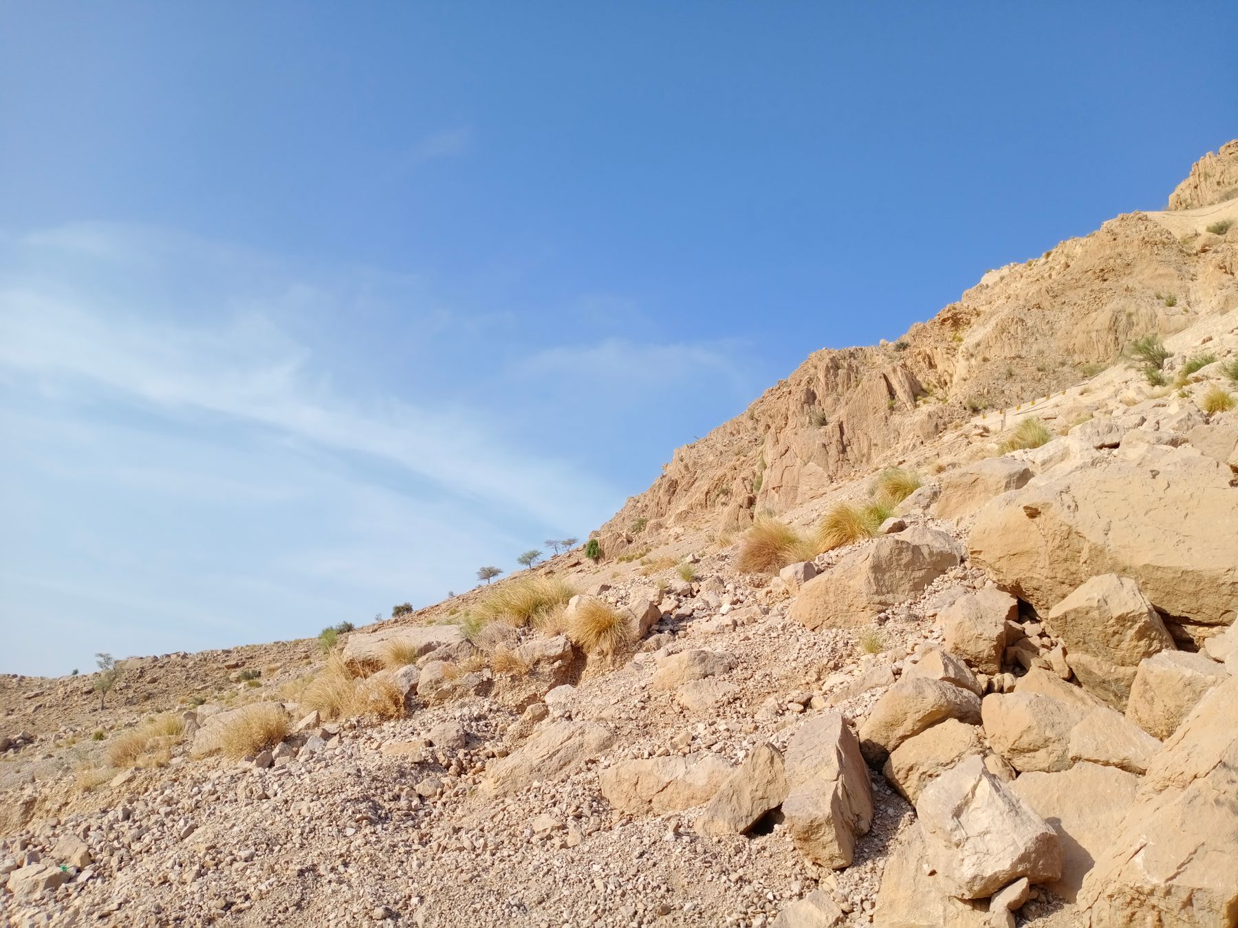
Gorakh Hill is a plateau of bare rock and low scrub in the Kirthar Range. The air is noticeably cooler than the Sindh plains, and in winter nights can be cold enough for a jacket. On clear days the view takes in layered ridges running west towards Balochistan. Cloud and mist can arrive quickly and hide the view for hours.
The settlement on top is small and simple. There are a few rest points and basic shelters, and the surrounding land is open and quiet. This is not a developed resort, and travellers should expect rough ground, limited services and a working mountain landscape.
Weather and seasons
The best months are October to March, when days are mild and skies often clear. December and January can bring cold nights and strong wind. From April the heat builds on the plains below and the hill becomes a summer escape, though the monsoon months of July and August can bring rain, cloud and difficult road conditions.
What to see
The main reason to come is the view and the cool air. The plateau edge gives long sightlines over the Kirthar Range, and the light changes quickly through the day. Sunrise and late afternoon are the best times to be on the ridge. Birdlife is present in the scrub, and the surrounding park protects mountain wildlife.
The hill is also a base for walking. Tracks lead along the plateau and towards nearby ridges, though paths are informal and not marked. A local guide is useful for longer walks. The villages at the foot of the hill, such as Wahi Pandhi, give a sense of the dry farming life of the region.
Kirthar National Park
The hill lies within or close to Kirthar National Park, a large protected area of mountains and valleys. The park is known for Sindh ibex and urial, and leopard are present but rarely seen. Wildlife is shy, so early mornings and quiet movement give the best chance of sightings.
A day or two there
A common plan is to leave Karachi or Hyderabad early, reach the foot of the hill by mid-morning and drive up for the afternoon and sunset. Many visitors return the same day, but staying overnight gives a quieter experience and a chance to see sunrise. Accommodation on top is basic, so check what is available before relying on it.
With two days, add a stop at Sehwan Sharif on the way, or explore the lower valleys around Wahi Pandhi. Keep the pace slow: the road up is slow and the altitude, though modest, can be felt on walks. Carry water, food and a warm layer, and allow extra time for the return drive.
Getting there and around
The usual route is from Dadu, which is connected by road and rail to Karachi, Hyderabad and Larkana. From Dadu, a road runs west towards Wahi Pandhi and then climbs to Gorakh Hill. The mountain section is steep and narrow in places, and a sturdy vehicle is sensible. Driving times vary with road conditions, so start early and avoid the climb after dark.
Public transport reaches the villages at the foot of the hill, but services to the top are limited. Many visitors arrange a vehicle and driver from Dadu or Sehwan. On the plateau, walking is the way to get around. Fuel and supplies should be bought on the plains before the climb.
Access and permits
Gorakh Hill is in a border district, and rules on access can change. Some areas nearby may require a No Objection Certificate (NOC) or have travel advisories. Check current official advice before travelling, and carry identification. Conditions on the ground matter more than any fixed rule.
Practical notes
Facilities on the hill are limited. There are basic rest points and shelters, but no range of shops or services. Bring drinking water, food for the day, a torch, sun protection and warm clothing for the evening. Mobile signal can be weak or absent. A fee may be charged at the park or at rest points.
The road can be affected by rain and landslides, especially in the monsoon months. Check road conditions locally before setting out. Travel in daylight where possible, and tell someone your plan. In summer the plains are extremely hot, so carry more water than seems necessary.
Frequently asked questions
Where is Gorakh Hill in Sindh?
Gorakh Hill is in Dadu District, in the Kirthar Range on the border between Sindh and Balochistan. It lies west of the Indus plains, roughly south-west of Dadu town. The usual approach is by road from Dadu or Sehwan, via the village of Wahi Pandhi.
What is the best time to visit Gorakh Hill?
October to March is the most comfortable period, with mild days and clearer skies. December and January can be cold at night. April to June is hot on the plains but the hill remains cooler. July and August bring monsoon rain and possible road problems, so check conditions before going.
Do you need a permit for Gorakh Hill?
Gorakh Hill lies in a border district and access rules can change. Some nearby areas may require a No Objection Certificate (NOC) or have travel advisories. Check current official advice before travelling and carry identification. Conditions on the ground matter more than any fixed rule.
What facilities are there on Gorakh Hill?
Facilities are basic. There are a few rest points and simple shelters on the plateau, but no range of shops, restaurants or hotels. Bring your own water, food and warm clothing. Mobile signal can be weak. A fee may be charged at the park or at rest points.