Why the Passu Cones look like that
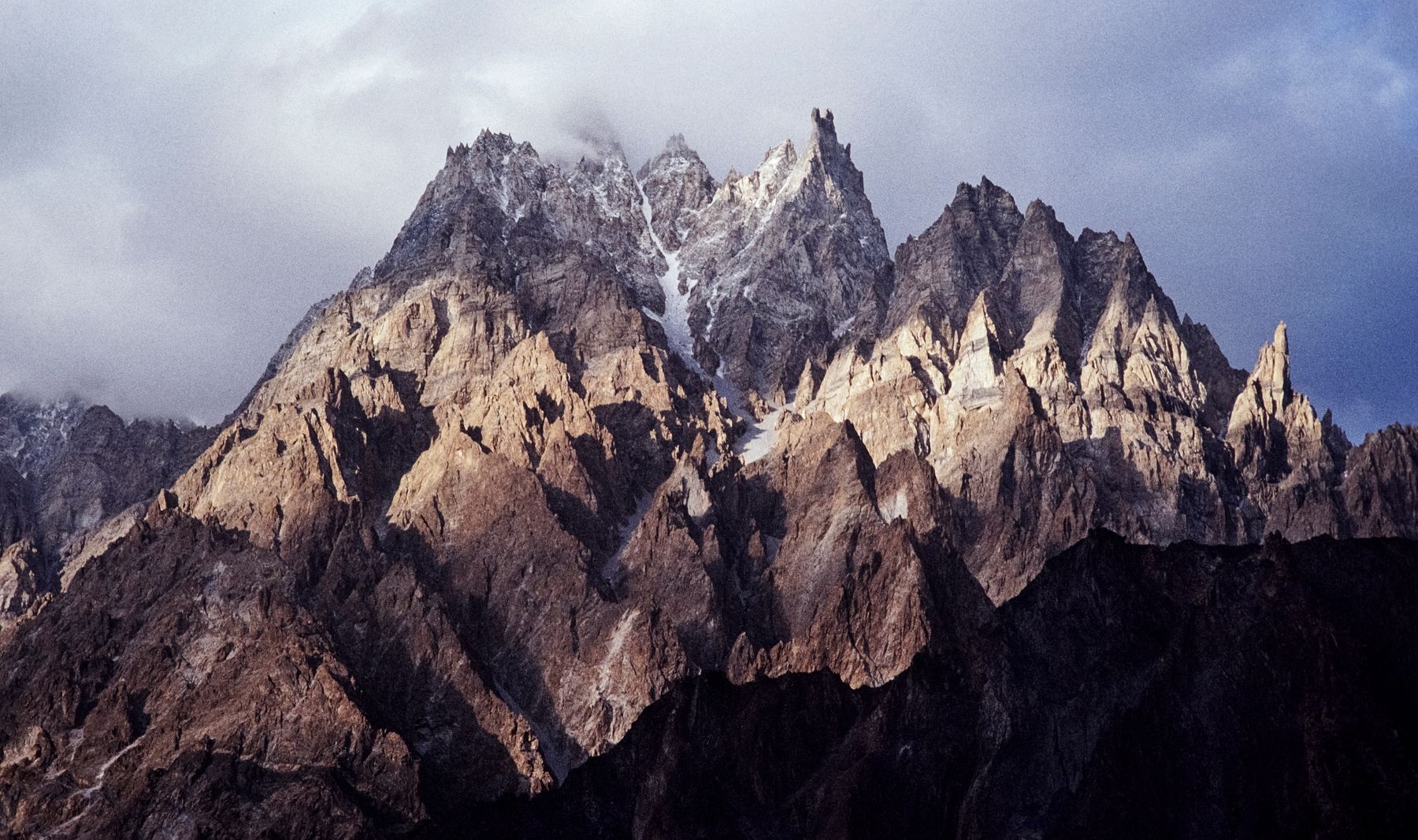
The sharp, striped peaks above Passu are not just photogenic. Their shape records millions of years of uplift, folding and glacial erosion in the Karakoram.
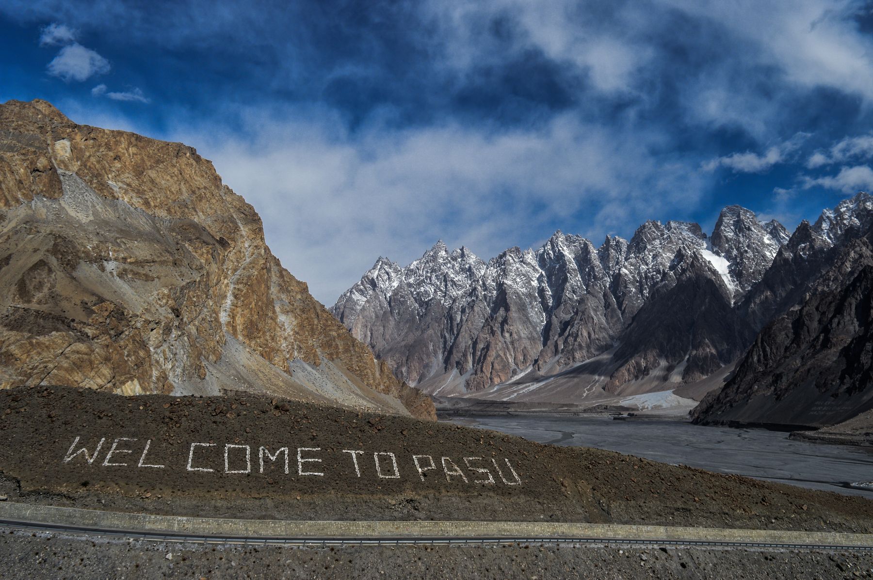 Photo: Hamza Gulzar / Pexels
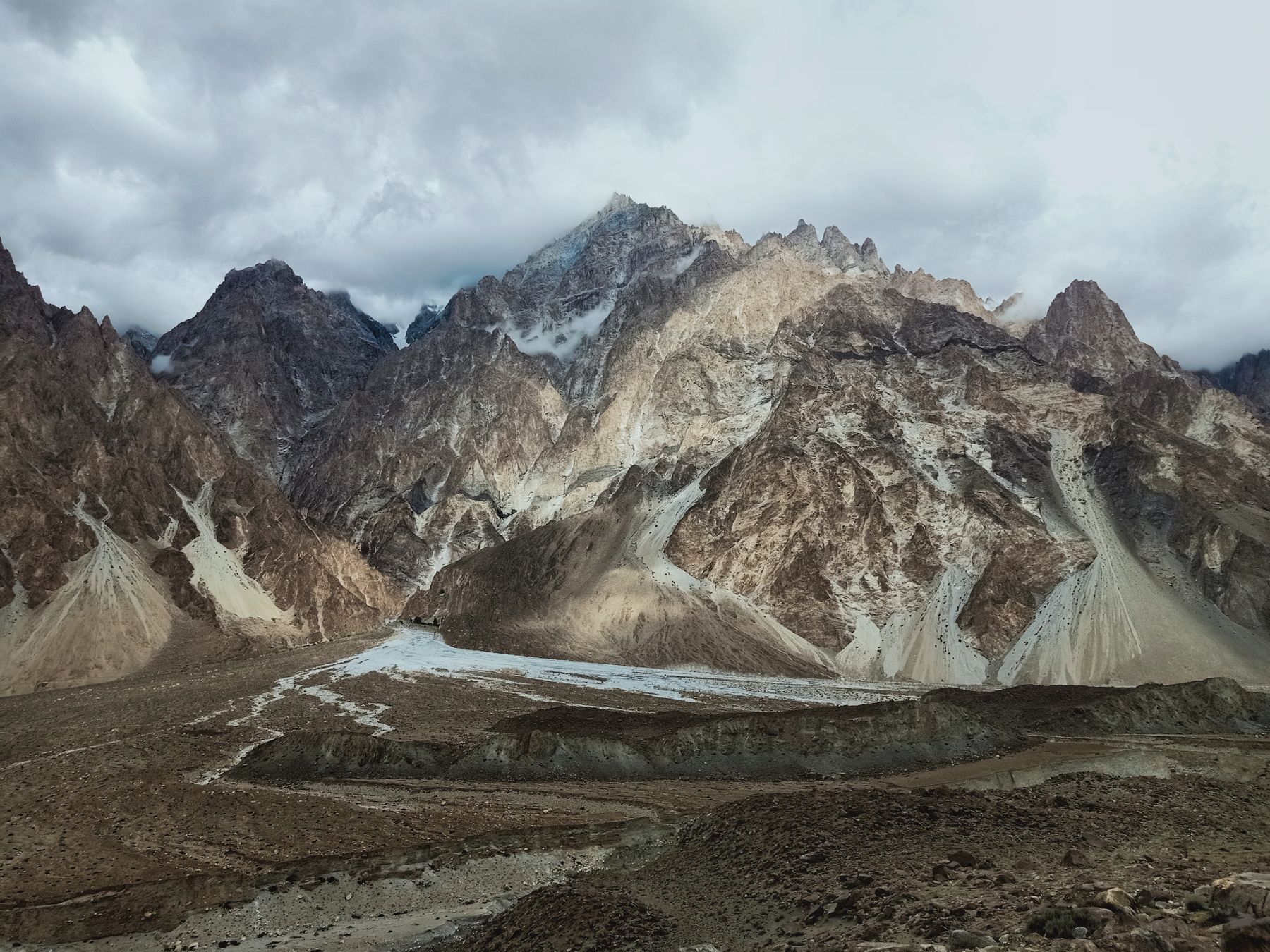
The Passu Cones stand above the Hunza River in Gilgit-Baltistan, a cluster of steep, ribbed peaks that rise abruptly from the valley floor. Their pointed summits and pale, banded faces are among the most recognisable silhouettes in the Karakoram. The form is the result of hard rock, intense folding and the slow work of ice and frost.
A landscape built by collision
The Karakoram range is a product of the collision between the Indian and Eurasian plates, which began tens of millions of years ago and continues today. The collision lifted and folded sedimentary and metamorphic rocks that had formed on an ancient sea floor. Around Passu, these rocks were compressed into tight folds and later exposed by erosion. The cones are part of that deformed sequence, tilted and fractured by the same forces that raised the range.
The rock layers visible on the cones are not uniform. Harder bands of rock alternate with softer ones, and the difference in resistance to erosion creates the ribbed texture. Where the rock is more resistant, ridges stand proud. Where it is weaker, gullies form. This contrast is one reason the peaks look striped and angular rather than smooth.
The Passu Cones are not a single mountain but a group of peaks. Their height is often given as around 6,000 metres, though the exact figure varies between summits. They sit close to the village of Passu, on the Karakoram Highway between Gilgit and Sost, making them accessible to travellers without a long trek.
Ice, frost and the shaping of peaks
Glaciers and seasonal snow have carved the cones. During colder periods, ice filled the valleys and scoured the rock. Today, small glaciers and snowfields remain on the upper slopes, and meltwater feeds streams that cut down through the valley sides. Frost action is also important. Water seeps into cracks, freezes, expands and prises rock apart, a process that sharpens ridges and steepens faces over time.
The result is a landscape of narrow crests, steep gullies and loose scree. The cones are not stable, and rockfall is common, especially after rain or snowmelt. This ongoing erosion is part of why the peaks look so sharp. They are being worn down even as tectonic forces push them up, a balance that keeps the profiles angular.
The nearby Batura Glacier, one of the longest in the Karakoram, lies to the north-west of Passu. Its presence shows how ice has shaped the wider region. The glacier and its meltwater have influenced the Hunza River valley, and the cones stand as a record of the same glacial history.
پسو کے مخروطThe cones of Passu, a local name for the peaks that dominate the valley.
What you can see from the valley
From the Karakoram Highway near Passu, the cones dominate the skyline. The best views are often in the early morning or late afternoon, when low light picks out the ridges and bands. The village of Passu sits below the peaks, surrounded by apricot and poplar trees. In spring, the trees flower and the contrast between blossom and rock is clear.
A short walk from the highway towards the Hunza River gives a different angle. The river runs grey with glacial silt, and the cones reflect in side channels. The old suspension bridge over the Hunza, near Passu, is a common viewpoint. It is a simple structure, and crossing it leads to paths on the opposite bank.
The area is also known for its fruit. Apricots are dried on rooftops in summer, and the local harvest is part of the valley's rhythm. Travellers may find apricot products in small shops in Passu and nearby Gulmit. The taste is sweet and slightly tart, a reminder of the orchards that thrive below the peaks.
Travel and access
Passu lies on the Karakoram Highway, about two to three hours by road from Gilgit. The highway continues north to Sost and the Khunjerab Pass, which leads to China. The pass is usually open from late spring to autumn, but snow can close it at other times. Travellers should check current road conditions before setting out.
The region is in Gilgit-Baltistan. Most visits do not require a special permit, but rules can change. Areas near the Line of Control and some border districts may need a No Objection Certificate (NOC). It is wise to check current official advice before travel. The Karakoram Highway is generally busy with local traffic and goods vehicles.
Accommodation is available in Passu and nearby Gulmit, though this page does not name specific establishments. The season runs from April to October, when the road is clear and the weather is milder. Winter brings snow and colder temperatures, and some facilities close. The cones remain visible year-round, but access is easier in the warmer months.
Why the shape matters
The Passu Cones are a visible lesson in geology. Their form shows how rock type, folding and erosion interact. The sharp profiles are not simply the result of height, but of the way different layers wear away at different rates. This makes them a useful place to observe mountain-building processes.
The cones also sit at a crossroads of cultures. The Karakoram Highway brings travellers through the Hunza Valley, and the area has a mix of Burusho, Wakhi and other communities. The landscape has shaped settlement patterns, with villages placed on fans and terraces where water is available.
For a visitor, the cones are a landmark that changes with the light. They can appear pale and uniform at midday, then reveal their ribs and shadows in the evening. The view from the valley floor is enough for many, but those who walk a little further will find quieter angles and a sense of the scale of the Karakoram.
Where to see the cones
- PassuThe village below the cones, with views from the Karakoram Highway and orchards.
- GulmitA nearby town with guest houses and a view across the Hunza River to the peaks.
- Hunza River bridgeThe old suspension bridge near Passu offers a clear angle on the cones.
- Batura Glacier viewpointA short drive north-west gives a wider view of the glacial landscape.
Frequently asked questions
What are the Passu Cones made of?
The cones are formed from layered sedimentary and metamorphic rocks that were folded and uplifted during the collision of the Indian and Eurasian plates. Harder bands resist erosion, creating the ribbed texture, while softer layers wear away to form gullies.
Do you need a permit to visit Passu?
Most visits to Passu and the Hunza Valley do not require a special permit. However, some border areas and districts near the Line of Control may need a No Objection Certificate (NOC). Rules change, so check current official advice before travelling.
When is the best time to see the Passu Cones?
The cones are visible year-round, but the Karakoram Highway is usually clear from April to October. Spring brings apricot blossom, while autumn offers clear skies. Winter can bring snow and road closures, so check conditions before setting out.
Find a stay in Passu
Live prices and availability open in the IMPT app, in a new tab.