 Photo:
A travel guide to Islamabad Capital Territory
This guide covers the territory in practical sections: where it is, when to visit, how to arrive, the main areas and routes, getting around, permits and safety, food and customs, and suggested itineraries. It focuses on places rather than businesses, and on what you can see and do in a short stay.
Where it is
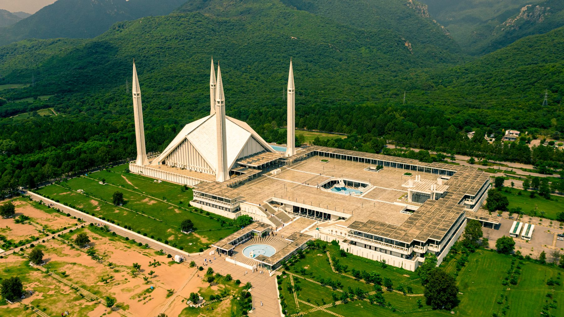
Islamabad Capital Territory lies in northern Pakistan, between the Potohar Plateau and the foothills of the Himalaya. The territory is small, about 900 square kilometres, and is separate from the surrounding provinces. Khyber Pakhtunkhwa lies to the north and west, Punjab to the south and east. The Margalla Hills form a green backdrop to the north of the city.
The city of Islamabad is the capital of Pakistan and the seat of government. It was built in the 1960s on a grid plan, with wide roads and sectors named by letter and number. The older settlement of Saidpur sits in the foothills of the Margallas, and the hills themselves rise to over 1,600 metres at their highest point.
Best time to visit
The best months are October to April. Autumn and winter bring clear, cool days, with temperatures in the city often between 10°C and 25°C. Mornings can be foggy in December and January, and the hills are cold at night. Spring, from March to April, is mild and the trees are in leaf.
Summers, from May to September, are hot in the city, with temperatures often above 35°C. The monsoon rains arrive in July and August, bringing humidity and sudden downpours. The Margalla Hills are greener then, but leeches and slippery trails can make hiking less pleasant. Winter is the driest season and the best for walking.
Getting there
Most visitors arrive by air at Islamabad International Airport, about 20 to 30 kilometres west of the city centre. The airport has domestic and international flights. From the airport, taxis and ride-hailing services are available. There is no railway station at the airport; the main railway station is in the city, with services to Lahore, Peshawar and Karachi.
By road, Islamabad is connected to Lahore by the M-2 motorway, to Peshawar by the M-1, and to the north by the Karakoram Highway. Buses and coaches run from Lahore, Peshawar and other cities. The journey from Lahore takes about four to five hours by motorway. From Peshawar, it is about two to three hours.
Islamabad city
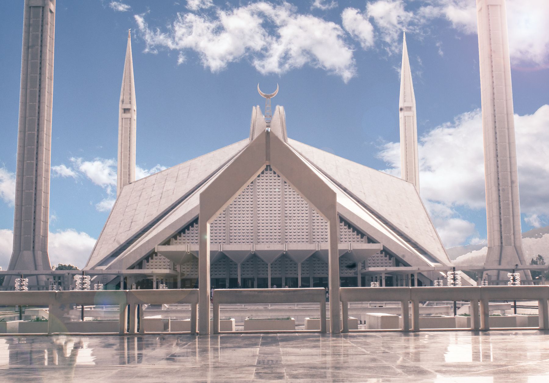
Islamabad is a planned city of wide avenues and sectors. The main sights include the Faisal Mosque, one of the largest mosques in the world, and the Pakistan Monument on Shakarparian Hill. The city is divided into sectors, each with its own market and amenities. The Blue Area is the main commercial district, with banks, offices and shops.
The city has several parks and green spaces, including Fatima Jinnah Park and the Shakarparian Hills. The Islamabad Zoo is in the foothills of the Margallas. The city is also home to several museums and galleries, including the Lok Virsa Museum of folk heritage and the Pakistan Museum of Natural History.
Faisal Mosque
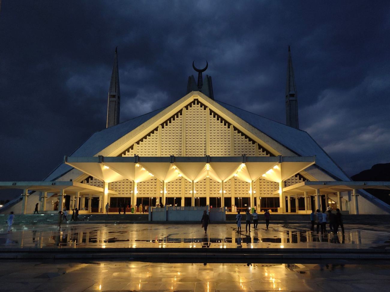
The Faisal Mosque is a landmark of Islamabad, designed by Turkish architect Vedat Dalokay and completed in 1986. It sits at the foot of the Margalla Hills and can hold tens of thousands of worshippers. The mosque is open to visitors outside prayer times, and a fee may be charged for entry to certain areas. Dress modestly.
Pakistan Monument
The Pakistan Monument is on Shakarparian Hill, south of the city centre. It is a national monument shaped like a blooming flower, with murals inside. The adjoining museum displays exhibits on Pakistani history and culture. The site offers views over the city and is popular at sunset.
Saidpur village
Saidpur is an old village in the foothills of the Margalla Hills, now within Islamabad. It is known for its narrow lanes, old houses and a small bazaar. The village has been restored in parts, with cafes and craft shops. It is a short drive from the city centre and makes an easy half-day trip.
The village has a Hindu temple and a mosque, reflecting its mixed history. The temple is no longer in active use but is a reminder of the area's past. The streets are paved with stone, and some buildings date back several centuries. Saidpur is busiest at weekends, when families come for walks and meals.
Margalla Hills
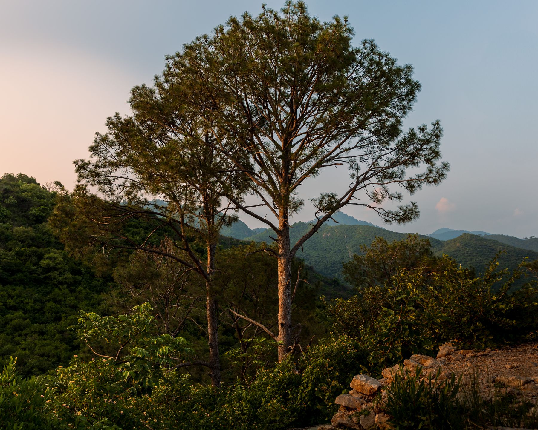
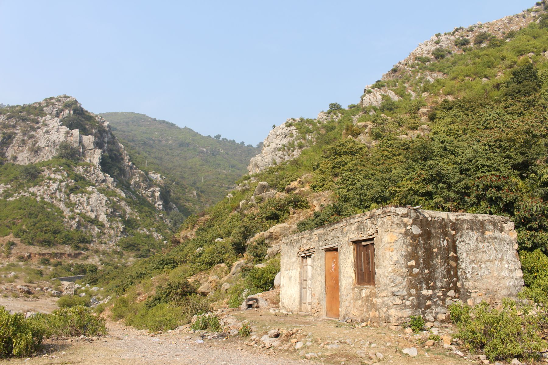
The Margalla Hills rise north of Islamabad and form the backdrop to the city. They are part of the Himalayan foothills and are covered in scrub forest and grassland. The hills are a national park, with several marked trails for walking. The highest point in the territory is Saidpur Peak, at 1,604 metres.
The hills are home to wildlife including monkeys, wild boar and many bird species. The trails range from easy walks to steeper climbs. The most popular trail is Trail 5, which starts near the Faisal Mosque and leads to a viewpoint. Trail 3 is another well-known route, starting from the Margalla Road.
Trail 5
Trail 5 is a popular hiking route in the Margalla Hills, starting near the Faisal Mosque. The trail climbs through forest to a ridge with views over the city. It takes about two to three hours to walk up and back. The path is well used and generally clear, but carry water and avoid the midday heat.
Daman-e-Koh
Daman-e-Koh is a viewpoint in the Margalla Hills, about halfway up the road to Pir Sohawa. It has terraces and a small park, with views over Islamabad. It is a popular spot for families and tourists, especially in the evening. Food stalls and a restaurant are available, and a fee may be charged for parking.
Getting around
Within Islamabad, taxis and ride-hailing apps are the most convenient way to travel. Fares are metered or agreed in advance. Public buses and minibuses serve many routes, but they can be crowded and slow. The city is spread out, so walking between sectors is not always practical.
For the Margalla Hills and Saidpur, a taxi or private car is the easiest option. The roads are paved and signposted. Car rental is available in the city, but driving can be hectic for visitors unfamiliar with local traffic. A day hire with a driver is a common choice for trips to the hills and nearby sites.
Practical matters
No special permit is normally needed to visit Islamabad Capital Territory. However, some areas near the Line of Control in Azad Kashmir and parts of Balochistan require a No Objection Certificate (NOC). If you plan to travel onwards to those regions, check current rules with the relevant authorities before you go. Rules change, so confirm before departure.
Cash is widely used, and ATMs are available in the city. Credit cards are accepted in larger hotels and restaurants, but smaller shops may not take them. Mobile signal is generally good in the city, but can be weak in the hills. Safety is generally good, but take normal precautions, especially at night and in crowded places.
Food and customs
Pakistani food is the mainstay, with dishes such as biryani, kebabs, curries and fresh bread. Islamabad has a range of restaurants, from street food to fine dining. Alcohol is not widely available, as Pakistan is an Islamic republic. Dress is modest, especially in mosques and older areas. During Ramadan, eating and drinking in public during daylight hours is discouraged.
Hospitality is important, and offers of tea or food are common. Accepting them is polite. When visiting mosques, remove shoes and cover heads and shoulders. Photography of sensitive buildings, such as military installations, should be avoided. Ask before taking pictures of people.
Suggested itineraries
For a short stay, spend one day in the city seeing the Faisal Mosque, the Pakistan Monument and the Blue Area. On the second day, take a taxi to Saidpur for a walk and lunch, then continue to Daman-e-Koh for views. If you have a third day, hike Trail 5 in the morning and visit the Lok Virsa Museum in the afternoon.
For a longer stay, add a day trip to Taxila, an ancient archaeological site about 30 kilometres west of Islamabad. Or drive up to Pir Sohawa for a meal with a view. Islamabad is also a good base for trips north to Hunza and Gilgit, which can be reached by road or by air from Islamabad International Airport.
Frequently asked questions
What is the best time to visit Islamabad Capital Territory?
The best months are October to April, when days are cool and clear. Spring, from March to April, is mild and green. Summers are hot, and the monsoon brings rain in July and August. Winter mornings can be foggy, but the hills are crisp and good for walking.
Do I need a permit to visit Islamabad Capital Territory?
No special permit is normally needed for Islamabad itself. However, if you plan to travel onwards to areas near the Line of Control in Azad Kashmir or parts of Balochistan, a No Objection Certificate (NOC) may be required. Rules change, so check current official advice before you go.
How do most visitors get to Islamabad?
Most visitors arrive by air at Islamabad International Airport, which has domestic and international flights. By road, the city is connected to Lahore and Peshawar by motorway, and to the north by the Karakoram Highway. Buses and taxis are available from the airport and city.
What are the main places to see in Islamabad Capital Territory?
The main places include the Faisal Mosque, the Pakistan Monument, Saidpur village and the Margalla Hills. The hills have walking trails such as Trail 5, and viewpoints like Daman-e-Koh. The city also has museums and parks, including the Lok Virsa Museum and Fatima Jinnah Park.
Is Islamabad a good base for trips to northern Pakistan?
Yes, Islamabad is a common starting point for trips north. The Karakoram Highway leads to Gilgit-Baltistan, and flights connect Islamabad with Gilgit and Skardu. Many travellers spend a day or two in the capital before heading to Hunza, Skardu or other northern valleys.