 Photo:


Visiting Fairy Meadows
What the place is like
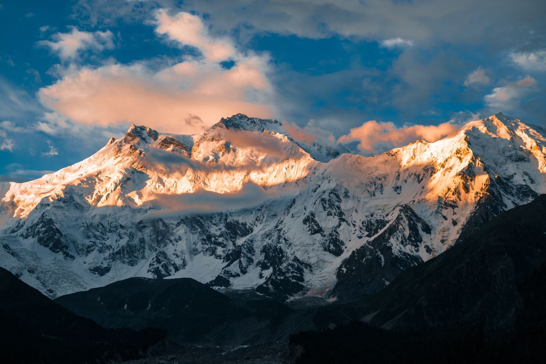
Fairy Meadows is a grassy shelf on the north side of the Nanga Parbat massif. The ground is uneven and dotted with pines. The meadow is not a village. It has a small number of seasonal huts and camping areas. The air is thin at this height, and nights are cold even in midsummer. The mountain wall stands directly above, and the face is often in cloud by afternoon.
The setting is forested below and rocky above. The Raikot Glacier lies to the south, and the valley drops steeply towards the Karakoram Highway. The meadow is used as a summer pasture by local herders, and the grazing season sets the rhythm of the place.
The mountain view
The north face of Nanga Parbat is one of the largest mountain walls in the Himalaya. From the meadow, the face fills the sky to the south. Clear mornings give the sharpest view before cloud builds.
What to see
The main sight is Nanga Parbat itself. The face is best seen at dawn and in the early morning. The meadow also gives views down the Raikot valley and across to the ridges on the opposite side. The pine forest around the meadow holds birds and, occasionally, markhor on the slopes.
A short walk from the meadow leads to viewpoints over the glacier. The trail to Beyal Camp continues up the valley and gives a different angle on the mountain. The base camp area, further on, is used by expeditions in summer.
A day or two there
Most visitors stay one or two nights. A common pattern is to arrive in the afternoon, walk a little around the meadow, and watch the mountain at sunset. The next morning, before cloud arrives, is the best time for the view. A walk to Beyal Camp takes about two hours each way and can fill a day.
If time allows, a further walk towards the base camp gives a closer look at the glacier and the mountain. This is a full day and should be started early. Nights are cold, and a warm layer is needed even in July.
Walking times
The meadow is small and can be crossed in minutes. The walk to Beyal Camp is the most popular half-day outing. The route to base camp is longer and rougher, and a local guide is useful.
Getting there and around
Access is from the Karakoram Highway at Raikot Bridge, between Chilas and Gilgit. From the bridge, a rough jeep track climbs to Tato village. The track is narrow and steep in places, and local jeeps are the usual transport. From Tato, a walking trail climbs through forest to the meadow, taking about two to three hours.
The jeep track and trail are usually open from late spring to autumn. In winter, snow may close the route. There are no roads on the meadow itself, and all movement is on foot. Porters and mules can be arranged at Tato for luggage.
From Gilgit or Chilas
Raikot Bridge is about two hours by road from Chilas and three to four hours from Gilgit, depending on conditions. Buses and vans on the Karakoram Highway stop at the bridge.
Practical notes
The meadow is inside the Nanga Parbat buffer zone, and a permit fee is charged. Rules can change, so check current official advice before travelling. The area is remote, and medical facilities are limited. Altitude is about 3,300 m, so allow time to acclimatise and watch for symptoms of altitude sickness.
Weather changes quickly. Afternoon cloud and rain are common in summer. Carry warm and waterproof clothing, and a torch. Cash is needed, as there are no banks or ATMs. Mobile signal is weak or absent. Take rubbish back down the trail.
When to go
The season runs from June to September. July and August are warmest, but also wettest. June and September often give clearer skies. Snow can linger on the trail in early June.
Frequently asked questions
How high is Fairy Meadows?
Fairy Meadows sits at about 3,300 m on the north side of Nanga Parbat. The altitude is enough to feel on exertion, so a slow approach and a rest day help. Nights are cold even in summer.
How do you get to Fairy Meadows?
Travel to Raikot Bridge on the Karakoram Highway, take a local jeep to Tato village, then walk about two to three hours up the trail. The jeep track is rough and the walk is steep in places.
When is the best time to visit Fairy Meadows?
June to September is the usual season. July and August are warmest but can be cloudy. June and September often have clearer mornings. The trail may be snow-covered outside these months.
Do you need a permit for Fairy Meadows?
The meadow is within the Nanga Parbat buffer zone, and a permit fee is charged. Rules change, so check with official sources before you go. Carry identification and allow time for formalities.